Garmin eTrex Solar Review (2026): Sun-Fed Simplicity
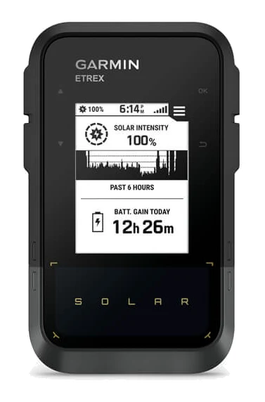
The Garmin eTrex Solar is a rugged, button-operated handheld GPS that can top itself up in sunlight. Here is what its specs and expert reviews say about who it suits.
Research-based · We earn from qualifying purchases
Our verdict
The eTrex Solar suits hikers and backpackers who want a rugged, long-lasting GPS with accurate positioning and don't need detailed onscreen maps. Anyone who wants topo maps, turn-by-turn guidance or a larger color display should look at a more capable handheld.
The good
- Solar charging can extend battery life indefinitely in bright, sunny conditions
- Multi-band GPS gives accurate positioning, including under tree cover
- Up to 1,800 hours in expedition mode without needing a recharge
- Simple button controls that work with gloves
- Lightweight, compact, IPX7 water-resistant build with readable sunlit screen
+2 more
- Simple button controls that work with gloves
- Lightweight, compact, IPX7 water-resistant build with readable sunlit screen
The bad
- No detailed maps and no way to add topo maps
- Small 2.2-inch monochrome screen limits map and data viewing
- Solar gains shrink in shade, overcast weather, dense forest or cold
- No turn-by-turn directions; weather and geocaching need a phone connection
+1 more
- No turn-by-turn directions; weather and geocaching need a phone connection
This Garmin eTrex Solar review looks at a handheld GPS built around one idea: a navigation tool that keeps going without constant charging. It adds a solar-assisted battery and multi-band positioning to the simple, button-driven eTrex format. It sits in the mid-range part of the market. It is aimed at hikers and backpackers who want a tough, long-lasting device with accurate positioning and don't need detailed maps on screen.
This review is based on Garmin's published specifications and on what independent expert reviews report. It is not based on hands-on testing.
Garmin eTrex Solar: specs at a glance
From the manufacturer- Weight
- 5.0 oz (141 g)
- Basemap
- Yes (cities only)
- Courses
- 50
- Display
- 2.2" transflective, monochrome
- Interface
- USB-C
- Dimensions
- 2.5" x 4.1" x 1.2" (6.4 cm x 10.5 cm x 3.1 cm)
- Battery type
- Rechargeable, built-in lithium-ion
- Water rating
- IPX7
- Internal memory
- 28 MB
- Display resolution
- 240 x 320 pixels
- Battery life (solar)
- Unlimited when used in 75,000 lux conditions
- Operating temperature range
- -20° to 60°C (-4° to 140°F)
- Waypoints/favorites/locations
- 1,000
- Battery life (expedition mode)
- Up to 1,800 hours
- Battery life (GPS-only tracking)
- Up to 200 hours
- Solar charging temperature range
- 0° to 60°C (32° to 140°F)
- Battery life (GNSS and multi-band tracking)
- Up to 100 hours
Key features
- Solar charging gives unlimited battery life in sunny 75,000 lux conditions
- Multi-band GPS for better positional accuracy in tough terrain
- 2.2-inch high-contrast display that stays readable in bright sunlight
- Digital compass gives an accurate heading even when you stand still
- Pairs with the Garmin Explore app for trip planning, weather, smart notifications and cloud storage
- Geocaching Live cache updates, with finds uploaded through the app
- IPX7 water-resistant build
- USB-C charging
What the Garmin eTrex Solar is (and isn't)
The eTrex Solar is a dedicated outdoor GPS, not a smartwatch or a phone replacement. It has a 2.2-inch transflective, monochrome display at 240 x 320 pixels, physical buttons, and a built-in rechargeable lithium-ion battery. Solar charging is the headline feature, and the multi-band GPS is the second.
It is just as important to know what it leaves out. The basemap covers cities only, and the device has no detailed maps and no way to add topo maps. It is a simple tracker rather than a full mapping handheld. Whether that suits you depends on how you navigate.
Design and build
The eTrex Solar weighs 5.0 oz (141 g) and measures 2.5" x 4.1" x 1.2" (6.4 cm x 10.5 cm x 3.1 cm). Reviewers describe the build as lightweight, compact and IPX7 water-resistant. IPX7 means it is designed to survive immersion in water, so rain and splashes shouldn't be a concern.
The operating temperature range is -20° to 60°C (-4° to 140°F). Solar charging works over a narrower range, 0° to 60°C (32° to 140°F), so don't count on solar top-ups in freezing weather.
The controls are buttons rather than a touchscreen. Reviewers praise the simple button controls because they work with gloves.
The 2.2-inch display is transflective, which means it uses ambient light to stay readable in bright sunlight. It is monochrome and small, though, and a common criticism is that it limits how much map and data you can see at once.
Solar charging in practice
Garmin says battery life is unlimited when the device is used in 75,000 lux conditions. That is bright, sunny weather, and it is the qualifier that matters. Reviewers note that solar gains shrink in shade, overcast weather, dense forest or cold. If your hikes are mostly under heavy tree cover or in gloomy conditions, treat solar as a bonus that stretches battery life rather than a guarantee of endless runtime.
The solar feature is best seen as insurance. On an open ridge or a long sunny trek, the device can top itself up as you walk. For everything else, the built-in battery figures matter more, and they are generous:
- Expedition mode: up to 1,800 hours
- GPS-only tracking: up to 200 hours
- GNSS and multi-band tracking: up to 100 hours
Those numbers show the trade-off. The more accuracy you ask for, the more power the device uses. Expedition mode stretches battery life furthest. Multi-band tracking has the shortest run time of the three modes, at up to 100 hours. USB-C charging means you can top up from a power bank or a standard charger, a convenience when you're carrying other USB-C gear.
Navigation and positioning
The multi-band GPS is the other reason to consider this model. Multi-band receivers use more than one frequency, which generally helps accuracy in difficult conditions such as canyons, ridgelines and tree cover. Reviewers specifically praise the accurate positioning, including under tree cover.
A digital compass gives an accurate heading even when you are standing still. A GPS-only heading depends on movement, so a built-in compass is useful when you stop at a junction to work out which way to go.
The storage figures reflect a basic navigation tool. You get 1,000 waypoints, favorites and locations, 50 courses and 28 MB of internal memory. That is enough for tracking routes, marking camps and saving points of interest. It isn't built for loading large map libraries. There are no turn-by-turn directions, so this is a device for following a track or a bearing, not for being told where to turn.
Smart features and the Garmin Explore app
The eTrex Solar pairs with the Garmin Explore app for trip planning, weather, smart notifications and cloud storage. That helps make up for the lack of onboard mapping: you can plan on your phone and carry the route on the handheld.
It is worth being clear about the limits. Weather and geocaching need a phone connection, as reviewers point out, so these features are not standalone. Geocaching Live provides cache updates, and finds are uploaded through the app. Geocachers get a handy field device with a long battery life, but the live elements depend on your phone.
What experts like and what they criticise
GearJunkie scores the eTrex Solar 7.9/10. Reviewers consistently praise a handful of things:
- Solar charging that can extend battery life indefinitely in bright, sunny conditions
- Accurate multi-band positioning, including under tree cover
- The long expedition-mode battery life of up to 1,800 hours
- Simple button controls that work with gloves
- A lightweight, compact, water-resistant build with a screen that is readable in sunlight
The criticisms are just as consistent, and some will be dealbreakers:
- No detailed maps and no way to add topo maps
- A small monochrome screen that limits map and data viewing
- Solar gains that shrink in shade, overcast weather, dense forest or cold
- No turn-by-turn directions, and weather and geocaching that need a phone connection
The missing maps are a major limitation. If you expect to look at a topo map on the device itself, this is the wrong tool. The strengths are all about durability, battery and accuracy.
Who should buy the eTrex Solar
This is a good fit if you:
- Hike or backpack and want a rugged GPS that doesn't demand frequent charging
- Value accurate positioning, including in tree-covered terrain
- Prefer buttons you can use with gloves over a touchscreen
- Are happy to plan routes in the Garmin Explore app and follow a track on the device
- Spend a lot of time in open, sunny terrain where solar charging can contribute
It is also a sensible backup device. A handheld that can run for a very long time in expedition mode is reassuring when your phone battery is running low.
Who should skip it
Look elsewhere if you:
- Want topo maps or detailed maps shown on the device
- Expect turn-by-turn guidance
- Want a large, color screen
- Hike mostly in dense forest, in persistent overcast or in cold, where solar gains shrink
- Want weather and geocaching features without relying on your phone
How it fits in its category
Handheld GPS units range from simple trackers to fully mapped touchscreen models. The eTrex Solar belongs at the simple, durable end. Its appeal is endurance, accuracy and ease of use, not the depth of its mapping. If detailed onscreen maps are central to how you navigate, a more capable handheld is the better route. If you mainly need a dependable breadcrumb tracker that lasts, this is a focused option.
Verdict: is the Garmin eTrex Solar worth it?
The Garmin eTrex Solar does a narrow job well. It pairs multi-band GPS accuracy with an exceptionally long battery life, with solar charging as a bonus in bright conditions. Its IPX7 build, glove-friendly buttons and sunlight-readable screen suit backcountry use. It is held back by the absence of detailed maps, the small monochrome screen and the lack of turn-by-turn directions, and its smart features lean on a phone connection. For hikers and backpackers who want a rugged, long-lasting GPS and are content to navigate by track and compass, it is a strong fit. For anyone who wants maps on the device, it isn't.
Related buying guides
Not sure about the Garmin eTrex Solar? Consider these
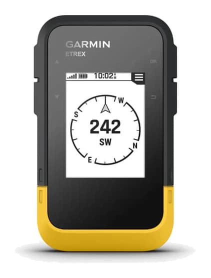
- Best OverallGarmin eTrex SEWhy we picked it →
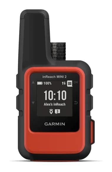
- Premium PickGarmin inReach Mini 2Why we picked it →
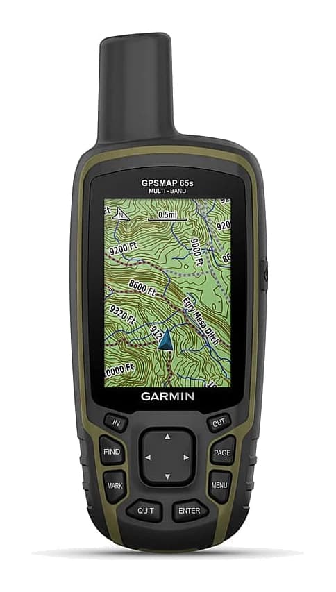
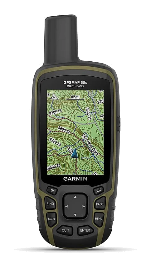
- Also GreatGarmin GPSMAP 65sWhy we picked it →
Frequently asked questions
Is the Garmin eTrex Solar worth it?
It is worth considering if you want a rugged, long-lasting handheld GPS with accurate positioning and don't need detailed onscreen maps. GearJunkie scores it 7.9/10. If you want topo maps, turn-by-turn directions or a large color display, a more capable handheld is a better match.
Does the Garmin eTrex Solar have maps?
It has a basemap that covers cities only. Reviewers note there are no detailed maps and no way to add topo maps, so it is best for following tracks and courses rather than reading maps on the device.
How long does the eTrex Solar battery last?
Garmin lists up to 1,800 hours in expedition mode, up to 200 hours in GPS-only tracking and up to 100 hours with GNSS and multi-band tracking. In 75,000 lux conditions, solar battery life is listed as unlimited.
Does solar charging work in the shade or in cold weather?
Less well. Reviewers note that solar gains shrink in shade, overcast weather, dense forest or cold. Garmin lists a solar charging temperature range of 0° to 60°C (32° to 140°F).
Is the Garmin eTrex Solar waterproof?
It has an IPX7 water-resistant rating, designed to handle immersion in water. That covers rain and splashes in normal hiking use.
Does the eTrex Solar give turn-by-turn directions?
No. Reviewers list the lack of turn-by-turn directions as a limitation. The device is designed for following tracks and courses, with a digital compass that gives a heading even when you're stationary.
Does the eTrex Solar work with a phone?
Yes. It pairs with the Garmin Explore app for trip planning, weather, smart notifications and cloud storage. Weather and geocaching features need a phone connection, and geocaching finds are uploaded through the app.
Sources
Specs are taken from the manufacturers' official pages; expert recommendations from the publications below.
- Garmin eTrex Solar: garmin.com, www8.garmin.com, spokex.com, rei.com
Related reviews & guides
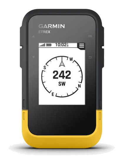
Garmin eTrex SE Review (2026): Long-Life Backup GPS
A look at the Garmin eTrex SE: a rugged, button-operated handheld GPS on swappable AA batteries, with the trade-offs of a monochrome screen and a cities-only basemap.
Published Oct 22, 2026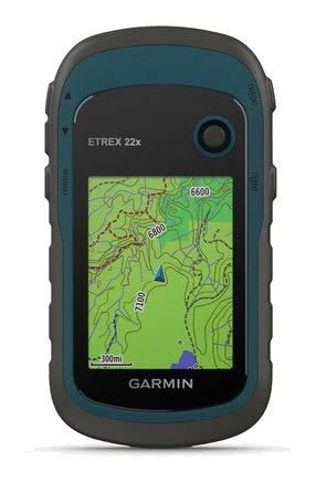
Garmin eTrex 22x Review (2026): Simple, Rugged, Dated?
The Garmin eTrex 22x is a rugged, no-frills handheld GPS with preloaded routable maps and swappable AA batteries. Here is who it suits and where it shows its age.
Published Oct 25, 2026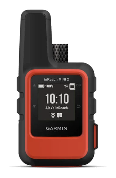
Garmin inReach Mini 2 Review (2026): Light, Rugged SOS
A look at the Garmin inReach Mini 2, a compact satellite communicator with two-way texting and SOS, based on manufacturer specs and what independent experts report.
Published Oct 29, 2026